Three days of rushing rapids, howling winds, and fishing. We spent another long weekend canoeing through the wild and wildly beautiful landscape of Northwestern Ontario following the Brightand River from one set of rapids to the next along a string of lakes that took us roughly 80 km along a linear route. What might have been an ambitious distance to cover in a relatively short amount of time was no problem with the pull of the current and the push of the wind. In fact, we clocked our “leisurely” speed (which involves a very low stroke speed, a lot of talking, and a fair amount of snacking) around 3-4 km/hr and our “normal” speed carried us forward between 5 – 8.8 km/hr (about 1-3 km/hr faster than we would expect). As you can image, it was amazing as long as waves didn’t threaten to break over the gunnels or flip us in which case Curniss got a little panicky. But the canoe stayed afloat and now we can tell you about our trip.
Highlights
- Spotting some pretty cool pictographs
- Great fishing / fresh pickerel for dinner every night
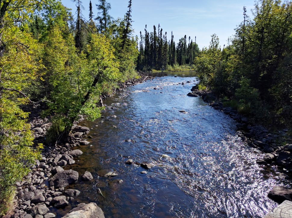
- Running rapids
- Discovering what’s around the river bend over and over
- Having the wind at our backs and the current in our direction most of the way
- Not seeing another human for over 50 hours
A Wilderness Highway
The Brightsand River flows from south to north over a distance of about 125 kilometers. Following it all the way north will take you to Wabakimi Provincial Park (in the Arctic watershed) while travelling east over the height of land at the kilometer 92 intersection of the Graham Road will take you into Kopka River Provincial Park (in the Lake Nipigon/Atlantic watershed). Check out this map of the area to get a sense of the terrain you can start to explore by canoe in this part of the country, and check out this blog post on our trip on the Kopka River in 2012.
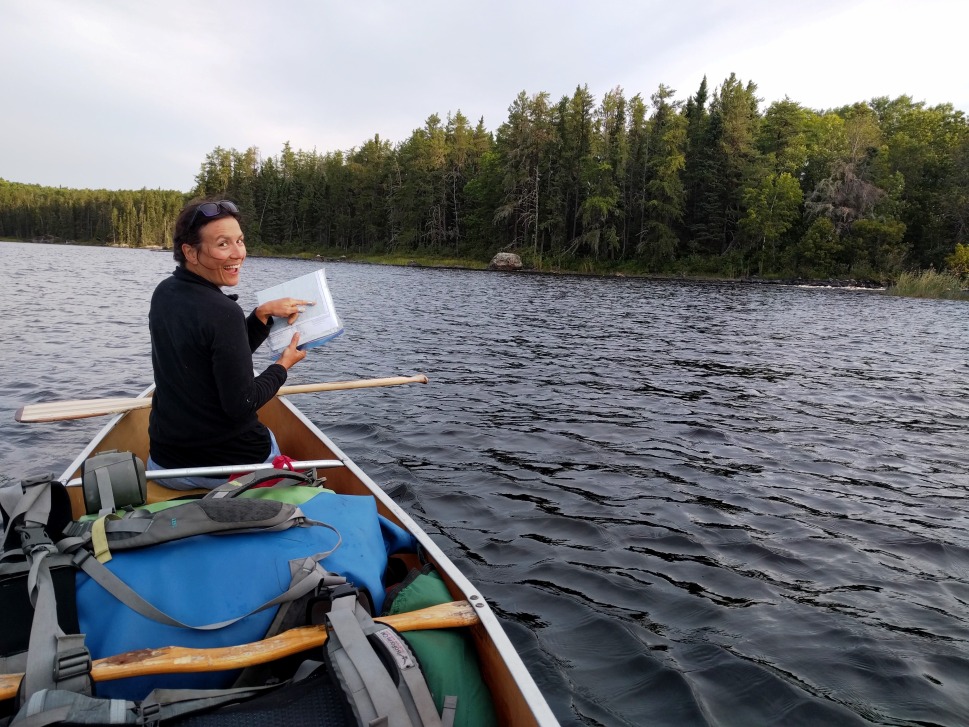
Our Route
We entered the Brightsand Provincial Park at kilometer 52 on the Graham Road around noon on day one. There are actually two access points to the park here; one places you directly on Aylsworth Lake and the other on a slow-moving and meandering part of the river that eventually also takes you to Aylsworth Lake in a round-about and scenic way. We came in the scenic way and it was lovely. From Aylsworth Lake we paddled west through Twining Lake and portaged past some rapids. There was a great campsite right next to these rapids (with a nice west-facing outcrop) and we decided to stay there our first night.
Day two was a bit of a beast-day and although we don’t know the exact distances we traveled, we figure we went approximately 40 kilometers. The wind was fierce and while we had to paddle into it for the first few kilometers, it was at our backs for the rest of the day and pushed us down Moberley Lake, made us fly through Little Metionga Lake, and helped us along as we hugged the north shore of Metionga Lake. We made it all the way to Brightsand Lake and slept very well that night.
On our last day we took things slowly and spent a lot of time fishing, lounging, and drifting with the wind still at our back. We saw other humans in a motor boat once we approached the Graham Road; a rude awakening from the sweet rhythm we were beginning to embrace. The end of the trip came too soon and before we knew it we were loading up the canoe onto Chris’ truck which we had shuttled to our exit point at kilometer 92 of the Graham Road prior to the start of the trip.
Access
The Brightsand River Provincial Park can be accessed via the Graham Road (a bumpy gravel logging road) which runs north of Highway 17 just west of Upsala. We have driven this road with both a small SUV and a 4×4 truck and definitly prefer doing the drive in the truck. We wouldn’t recommend going in with a small car and beware that when it rains the road can become pretty soupy in places.
Tips
- Paddling direction is key for this route – starting at the south end is the way to go. We traveled with the prevailing winds (south, southwest, west) and the current (south to north) which made life so much easier and enjoyable. It would have been a totally different trip if we would have spent the entire time fighting the ferocious wind and navigating swift sections of the river against the current.
- The wind and waves really picked up on the big lakes (Little Metionga, Metionga, and Brightsand) so planning to paddle these early in the day is a good idea.
- Maps with campsites and portages can be purchase online through Wabakimi Maps.
- Rapids that are mapped on detailed topographic maps of the area are really rapids and there will be a portage to get around them (in the Provincial Park anyway). On the other hand, there are a few rapids that aren’t marked on these maps but these can be paddled or walked. There were a total of five short portages in this part of the park.
- The portages along the route were pretty obvious but not always flagged (by way of wood board, Pringle bottle, piece of fabric or something similar).
- Fish every set of rapids – these were filled with pickerel and pike.
- Brightsand River Provincial Park is a non-operating park which means its free for us lucky Canadians!


")


")


This would make a good Story Map!
LikeLiked by 1 person
A friend and I are thinking of paddling some of this, so your pictures are really useful to give us an idea of what it is like. Keep n adventuring.
LikeLike
That is so great to hear – thanks for letting us know and have an amazing trip!
LikeLike
Looks like an awesome adventure. I just paddled up to top Of Moberly and back last weekend. I only had two days and no pick up so i had to make a short trip of it. I am currently working on a paddle planner website that will be a bit more interactive than other ones. http://www.mycanoecountry.ca , it may be helpful in future.. Just not so much yet. brand new.
LikeLike